
Parcel 16-2S-23-0000-0002-0000
Owners
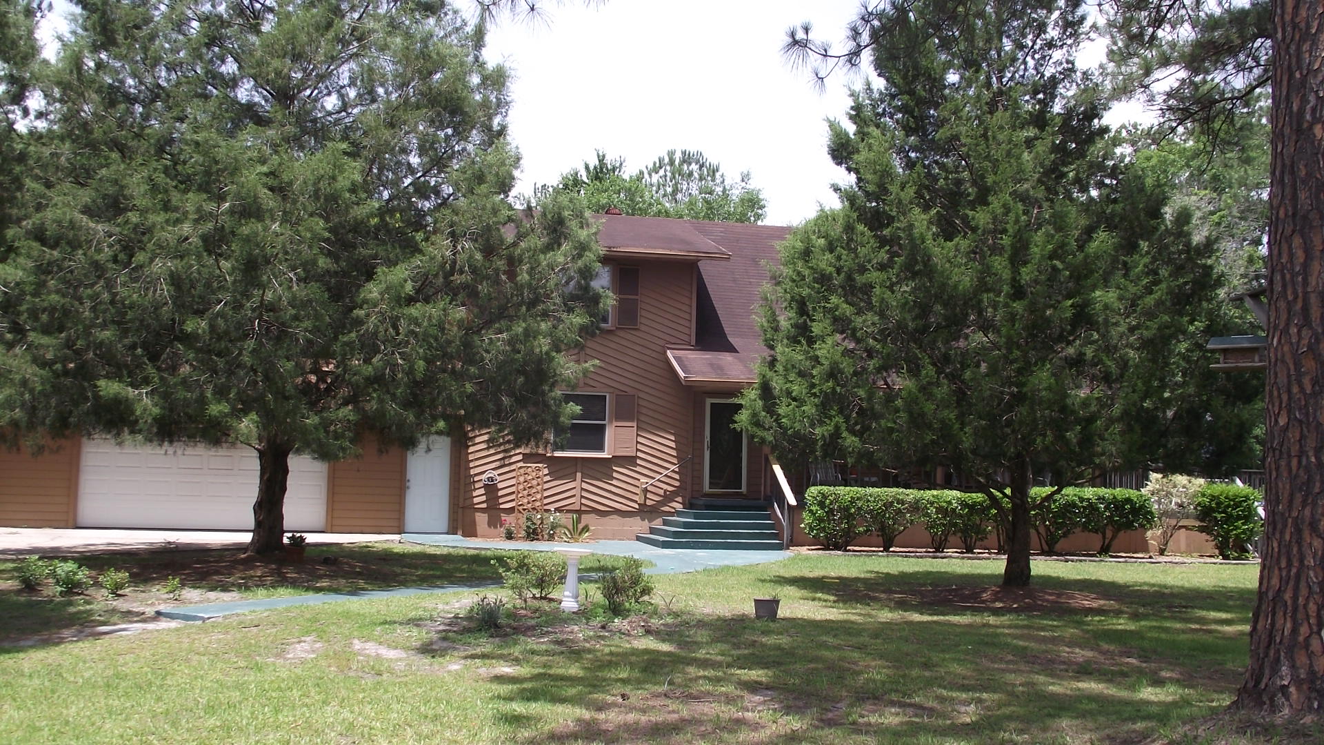
3520 C R 121
BALDWIN, FL 32234
Parcel Summary
| Situs Address | 3520 CR 121 |
|---|---|
| Use Code | 0100: SINGLE FAMILY |
| Tax District | 6: Drainage Dist |
| Acreage | 7.4500 |
| Section | 16 |
| Township | 2S |
| Range | 23 |
| Subdivision | |
| Exemptions | HX: Homestead (196.031(1)(a)) (100%) HB: Homestead Banded (196.031(1)(ab) (100%) |
Short Legal
S1/2 OF SE1/4 OF SW1/4IN OR 1983/510
EX 2-1 & 2-2
Values
| 2025 Preliminary Values | 2024 Certified Values | |
|---|---|---|
| Land Value * | $145,275 | $141,550 |
| (+) Improved Value | $342,491 | $328,464 |
| (=) Market Value | $487,766 | $470,014 |
| (-) Agricultural Classification | $0 | $0 |
| County Assessed Value | $246,530 | $239,582 |
| (=) School Taxable Value *** | $221,530 | $214,582 |
| (=) County Taxable Value | $195,808 | $189,582 |
Document/Transfer/Sales History
| Instrument / Official Record | Date | Q/U | V/I | Sale Price | Ownership |
|---|---|---|---|---|---|
| WD 1983/0510 | 2015-05-28 | Q | Improved | $200,000 | Grantor: BUTLER BILLY R Grantee: BALDWIN MICHAEL P |
| WD 1259/1228 | 2004-09-16 | Q | Improved | $257,900 | Grantor: WEAVER ROBERT E & Grantee: BUTLER BILLY R |
| WD 0910/1666 | 1999-12-09 | Q | Improved | $169,900 | Grantor: WILLIAMS RAYMOND O JR & CHERYL Grantee: WEAVER ROBERT & RENEE SWEITZER |
| WD 0459/0699 | 1985-07-01 | Q | Vacant | $29,800 |
Buildings
Building # 1, Section # 1, 282893, RESIDENTIAL
| Heated Sq Ft | Year Built | Value |
|---|---|---|
| 2156 | 1989 | $295,271 |
Structural Elements
| Type | Description | Code | Details |
|---|---|---|---|
| EW | Exterior Wall | 12 | CEDAR |
| EW | Exterior Wall | 10 | ABOVE AVG |
| RS | Roof Structure | 03 | GABLE/HIP |
| RC | Roof Cover | 03 | COMP SHNGL |
| IW | Interior Wall | 05 | DRYWALL |
| IW | Interior Wall | 06 | CUST PANEL |
| IF | Interior Flooring | 14 | CARPET |
| IF | Interior Flooring | 08 | SHT VINYL |
| AC | Air Conditioning | 03 | CENTRAL |
| HT | Heating Type | 04 | AIR DUCTED |
| BDR | Bedrooms | 3.00 | |
| BTH | Bathrooms | 2.00 | |
| FR | Frame | 02 | WOOD FRAME |
| STR | Stories | 1.5 | 1.5 |
Building # 2, Section # 1, 23162, RESIDENTIAL
| Heated Sq Ft | Year Built | Value |
|---|---|---|
| 1200 | 2006 | $23,230 |
Extra Features
| Code | Description | Length | Width | Units | Unit Price | AYB | % Good Condition | Final Value |
|---|---|---|---|---|---|---|---|---|
| 0810 | CONCRETE A | 197.00 | $6.50 | 1989 | 55% | $698 | ||
| 0811 | CONCRETE B | 778.00 | $5.20 | 1993 | 64% | $2,589 | ||
| 1242 | WD DECK A | 891.00 | $10.00 | 2005 | 22% | $1,960 | ||
| 0510 | GARAGE WD-MTL | 40 | 20 | 800.00 | $26.95 | 2000 | 27% | $5,821 |
| 0350 | CARPORT WD | 22 | 16 | 352.00 | $13.00 | 2002 | 20% | $915 |
| 0940 | SHEDS/PORT | 17 | 10 | 170.00 | $20.10 | 2003 | 20% | $683 |
| 0350 | CARPORT WD | 24 | 22 | 528.00 | $13.00 | 2003 | 20% | $1,373 |
| 0812 | CONCRETE C | 1190.00 | $4.00 | 2004 | 83% | $3,951 | ||
| 0936 | SEPTC TANK | 1.00 | $6,000.00 | 2020 | 100% | $6,000 |
Land Lines
Personal Property
None
TRIM Notices
Property Record Cards
Disclaimer
The Nassau County Property Appraiser's Office makes every effort to produce the most accurate information possible. No warranties, expressed or implied, are provided for the data herein, its use or interpretation. The information contained herein is for ad valorem tax assessment purposes only. The Property Appraiser exercises strict auditing procedures to ensure validity of any transaction received and posted by this office but cannot be responsible for errors or omissions in the information received from external sources. Due to the elapsed time between transactions in the marketplace, and the time that those transactions are received from the public and/or other jurisdictions, some transactions will not be reflected.